
I’ve made some graphs about Europe’s mountains, using data from this thorough report made by the European Union:

This graph above shows, approximately, the size of European countries’ mountainous areas (in the y axis) and how big their mountainous areas are as a share of their overall territories (in the x-axis). With the exception of Slovenia, the graph does not include any of the mountainous countries of the former Yugoslavia, since the report does not mention those countries. Nor does it mention Morocco, Turkey, Russia, Ukraine, or some of Europe’s other peripheral non-EU countries. Norway, though, which is not in the EU either, is included in the report, and as you can see it is by far the biggest outlier on the graph above.

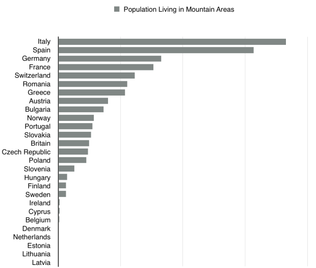
This graph above shows that, as one might expect, there is a strong correlation between how mountainous a European country is and how much of its population lives in mountainous areas. Switzerland leads in both categories, followed by Norway, Slovenia, Greece, and Austria.

In this graph above the main outliers are Italy and Spain, which have by far the largest populations living in mountainous areas. Had Turkey, Morocco, and Algeria been included, however, they would have been even further ahead of Italy and its 18 million people living in mountain areas.


1 Comment